This audit was organized through the Curran Hall Community Association (est. 1957) and led by this report’s author, association president Brian MacFarlane, drawing from experience of an almost thirty year career in the risk management industry and as a lifelong resident of the community for almost 60 years.
Aside from communicating about the road reconstruction project over the past four years through the Curran Hall Newsletter, a community newsletter published continuously since 1957, the call for community participation was extended to a relatively small segment of the population surrounding the road through several posts on the community association Facebook group “Curran Hall Community” , which currently has less than 800 followers. The walking audit was organized in response to widespread community concern, anxiety and complaint reaching an emotional level, in reaction to the early September full reopening of the road after much delay, occurring a year after its original expected opening and a succession of construction firms working on the project. Our experience of the newly rebuilt road presented us with many challenges in interpreting the changes that occurred and the many noticed deficiencies if left unchecked, were felt would introduce risks that would impede pedestrian, cyclist and motorist safety with a negative, possibly catastrophic impact on our community. This audit also includes observations from before and after the walking audit and the topics covered speak to how the road and the people who use it interact with the road during the week with nighttime, school and waste management traffic activity. The community walk also included several cyclists and besides the group of community participants which numbered about twenty five people, we were joined by Councillor Paul Ainslie, his executive assistant and four city staff members who were present to hear and observe many of the concerns of participants and to provide insight from their perspective of the project. I am very grateful for city staff’s interest and participation in this walk, especially since it occurred on a Sunday afternoon, likely not a work day for them.
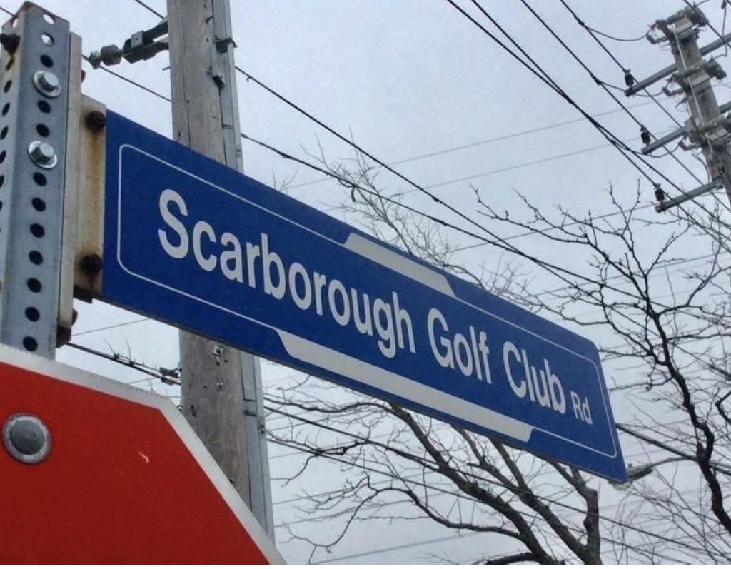
Scarborough Golf Club Rd. is one of Scarborough’s oldest roads, intersecting for many years with Asa Danforth’s original 1801 road, an important east west route for early pioneers, Danforth’s road now severed from its original path and renamed throughout Scarborough. The original concession road that would become Scarborough Golf Club Rd. was surveyed in 1862 by Frederick Passmore and existed as an idyllic country road for more than ninety years, within this time taking its name after the world renowned golf club to the south end of the road that opened in 1912. With the development of the surrounding farmland for housing that started in 1955 and in recent years the push for high density housing, the great challenge of this road as a major arterial road, predominantly also a route for many that do not live in its surrounding residential properties located between heavily used major roads, Ellesmere and Lawrence, has been how to move people safely through it.
Speed and driver behaviour on Scarborough Golf Club Rd. over the years has worsened resulting in rising incidents of accidents, death and serious injuries, necessitating a change to curb this worsening trend,leading to the criteria for the road’s reconstruction.
Upon completion of the roads reconstruction, with many elements compliant to the mandates set forth by the city of Toronto’s Vision Zero Plan, there have been many opinions expressed by members of the community about the finished product of rebuilt road. There are a great number that want the road returned to a four lane roadway and yet in doing this the initiative of reducing the speed, optimistically in hope to reduce or eliminate speed related accidents and fatalities, of which Scarborough Golf Club Rd. has had a number of, is lost, and the speed related accidents and fatalities will continue and will rise as the population density in the area grows with more cars on the road. Many too express concern about the narrow lanes for traffic on both side of the rebuilt road and are anxious about how an emergency vehicle would get through when the immediacy or lack thereof of their arrival effects residents health and home. Snowplows are another concern, not only being stuck behind one but also the width of their blade and the hazard that the curbed bioswale gardens with shorter curbs have, without there being some sort of signage, reflective marking or elevated feature that could distinguish this area and thereby protect it from vehicular impact damage, or for a part of the curb from being broken off and introduced into a lane of traffic. Although the concept of the bioswale gardens is attractive in that it softens the edges of the road, introduces a gateway feature of perennials leading to the Toronto and Region Conservation Authority (TRCA) Meadoway in the hydro field at the north end of the road, the current incarnation of this feature negates the concept positives and creates a liability risk.
If there is not the possibility of removing both bike lanes and bioswale features along the road, perhaps a compromise to reduce the width of bike lanes, bike lane radius turn areas at intersections and bioswale gardens, to allow a sufficient space for emergency vehicles, snow plows, waste management vehicles to pass, and for cars not to park in the protected bike lane area might alleviate some concerns.
A post construction community audit of Scarborough Golf Club Rd.
(Unless otherwise noted all photographs included in this report are by the author)
The start of the walking audit began on the northeast corner of Scarborough Golf Club Rd. and Lawrence Ave. E. – in review of this portion of the roadway the following was noted; the grading of Lawrence Ave. E. ascends west from the intersection. Traffic travelling north of Lawrence Ave. E. either westbound turning right from Lawrence Ave. E. or from traffic originating south of Lawrence Ave. E. – road conditions in this intersection during winter thaw and freeze or when there is freezing rain are very slippery and there is a tendency given the ineffectiveness of snow tires on ice surfaces for the grade of the road when turning to cause drifting of a vehicles position on the road, affected to varying degrees based on the speed travelled. At this intersection it is important to note that the northbound traffic on Scarborough Golf Club Rd. is entering into a narrow single lane and must at times compete with traffic turning right from Lawrence Ave. E. By not having a restriction on right turns on a red light, it is a critical omission that could increase the likelihood of vehicular impact especially when drivers speed is increased and road conditions are not favourable for good traction. At the northeast corner of this intersection, just north of Lawrence Ave.E., a protected bike lane radius turn has been installed.
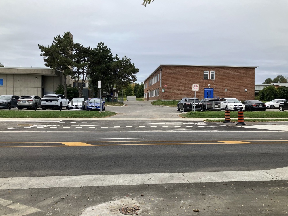
Some motorists have noticeably hesitated here when a right turn is signalled, possibly mistaking this for a turn lane based on its perceived width, giving the illusion that their vehicle can enter into this space. This area has an absence of signage to explain the intended use of this feature to motorists unfamiliar with it. On the opposite north west corner of the intersection is a marked turn lane which offers motorists travelling south the option to turn left. Next to it is a single lane to make a right turn or travel straight. On a week day behind a TTC Curran Hall 154 bus that had stopped at the corner of the intersection to drop off and pick up transit riders, were cars behind it and seeing the bus had stopped, motorists were using the left turn lane to drive around the bus to turn right onto Lawrence Ave. while a constant flow of passengers were either entering or leaving the bus until the light turned red. Then,with cars still behind the bus and on a green light, the bus’s four way flashers went on which prompted motorists who were quick enough to enter and use the left turn lane as a go around to make a right turn, however catching one motorist off guard trying to turn right from the left turn lane when the bus suddenly turned off the four way flashers and proceeded forward to make a right turn onto Lawrence Ave. E. travelling west and the traffic following behind the bus left the motorist in the left turn lane the only option to turn left and make a u turn after clearing the intersection.
It is important to note that the issue of a bus stopping at the intersection for purposes other than dropping off and picking up transit users creates a blind spot in an area of high traffic with two schools in very close proximity. It was also pointed out to project staff members during the stakeholder meetings in 2022 by myself and others, and witnessed then while a bus driver took his smoke break with the bus parked at the corner also with traffic turning around it.
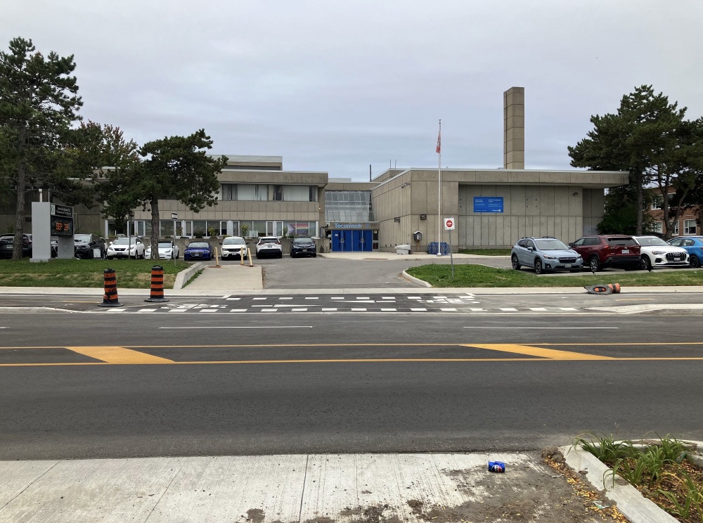
On the west side of the road just north of Lawrence Ave.E. are the Toronto District School Board properties Tecumseh S.P.S. and Golf Road P.S. On the day of the audit (a Sunday) arriving and departing traffic was absent. In on site viewings of both morning and afternoon taken place prior to the audit the following was noted; traffic waiting to exit to turn north or south must do so when there is a heavy volume of through traffic on the road, often edging into a lane of traffic to gain entry, often entering without a sufficient turning radius to clear into their lane without adjustment, thereby increasing their time in an oncoming lane and the likelihood of vehicular impact. A suggestion shared on the walking audit to mitigate this issue, given the volume of traffic in this area, is to mark this section to allow a designated turning radius with signage to the affect of “do not block intersection” with added installation of a flashing amber light to caution motorists.
Almost opposite of the school parking lot, just north of the entrance to Golfdale Plaza, adjacent to the bike lane is a curbed bioswale garden bed. What is notable about this feature and others along the road like it, is the height of the curb being lower than that of the curbs skirting the boulevard. On September 2nd of this year Toronto received a level of precipitation that has not been seen in the area since record level storms of August of 1976 and September 1977 that caused considerable flooding throughout Toronto. This past September Scarborough received the most accumulation and Scarborough Golf Club Rd. as a result of the project’s contractor not removing screening on storm drains, considerable ponding in the area in front of the school/Golfdale plaza, in front of Curran Hall Ravine Park, between Brimorton Drive and Greenock Ave. and areas north of Slan Ave.
Returning to the subject of the curbed bioswale garden north of the Golfdale plaza entrance -with the level of water exceeding the curb of the planter but not the curb adjacent to the boulevard and with lack of visible signage or reflective marking, a car drove over and into the curbed bioswale garden,sustaining damage.
North of here on the west side of the road on Chandler Drive it was mentioned that during school children drop off and pick up times with the road’s modified and now narrower connection to Scarborough Golf Club Rd. that cars block both sides of the road making exit and entry to Chandler Drive in this time and area difficult and dangerous. During the stakeholder group’s walk of the road several years ago the issue of the impact of displaced Scarborough Golf Club on road parking would have on side streets was discussed . The MTO prohibits parking within 9 metres of a stop sign, however in this location and others, without signage to remind people of the restriction and without traffic enforcement to create a financial penalty that would make the restriction visible and tangible, there is then the constant possibility for the risks the current situation provides to invite issues with pedestrian, cyclist and motorist interactions.
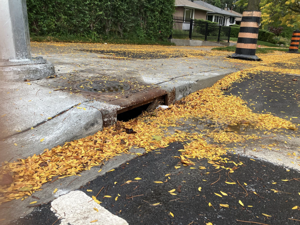
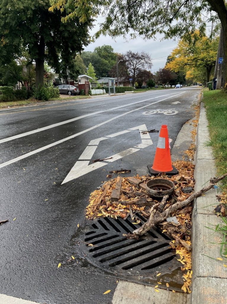
At the intersection of Brimorton Drive and Scarborough Golf Club Rd. the reoccurring issue of the width of the protected bike lane turn radius is apparent here in the tightness of the turn northbound from a westbound traffic approach along Brimorton. The rebuilding of the southeast corner has produced multiple issues, of missing pieces ( a large curb lane drain without a grate that visibly contained large debris), encroachment ( a home with a wire fence immediately against a newly built wider sidewalk and narrower original sidewalk), and the narrowing of an original, less wide sidewalk to the east along Brimorton Drive with the installation of a metal light stand pole immediately across from a hydro pole support wire and close by wooden hydro pole.
For several years the snow removal contractor commissioned by the city for our district of Toronto has proven constantly on multiple occasions that despite their confidence in being able to provide the services they are paid to provide, their competence is questionable based on the widespread damage to properties they routinely cause with sidewalk plows better suited for wider sidewalks, not the majority of less wide sidewalks that we have. With the installation of the light stand and the inability for a sidewalk plow to clear this narrower stretch of area, it is unlikely that the snow/ice will be cleared in an adequate way, increasing the likelihood of slip and fall incidents in this area, and/or property damage to pole/wire fence caused by too-wide plows attempting to clear the area. The same corner also has, what is a reoccurring theme throughout the project site in multiple areas, the remains of construction debris, either garbage, aggregate or metal.
Observations of parking along the reconstructed road has raised a number of concerns.
Although it seems the initiative of the project design was to limit on road parking to the west side, the absence of communication with the community to help them interpret the changes ( in multiple languages to accommodate the diversity of the populace), and the lack of signage throughout, has created confusion and the potential for risks related to parked cars affecting motorists and cyclists alike. The enormous width of the bike lanes, in some areas measuring over eight feet across, has become a curb protected on road parking spot for automobiles on the east side of the road. On the west side of the road, although there are in some areas throughout, designated on street parking areas, the areas of the road marked with white stripes, designated to protect the turning radius in front of homes in order to allow homeowners to safely turn from their driveway onto the now much narrower roadway, the marked turning radius is often used as an on road parking space.
While on the subject of signage, given the project’s emphasis of creating a safer, slower road, the project overview stated that upon completion of the rebuilt road that the speed limit would be reduced to a consistent 40km. Although both narrowed lanes are opened on the road for north/south traffic it was noticed that from just past the school zone north to Ellesmere Rd., that the 50km signs have not been replaced. The neglect of this factor after introducing on road features of garden beds, protruding curbed bioswale gardens and narrowed lanes introduces less driver response time during peak use times of the corridor, potentially increasing the likelihood of accidents to occur.
On two consecutive Fridays, Waste Management pick up days in the community, I was able to make observations, both as a pedestrian and also as a motorist. Residents along the road often put out garbage, not always on the week for scheduled pick up, resting their bins and/or larger items that could not fit into a bin, on the bike lane curb adjacent to the road. Variances on the size of the objects brought out by homeowners, items laid over the curb and in some cases entering a portion of the bike lane.Wooden boards-some without nails removed, furniture, glass panels, toilets, matresses-items in this area create not only the risk of injury to cyclists but also the potential with their position shifted to also affect the adjacent lane of traffic. Communication with residents on where they could safely put their waste while awaiting pick up should be initiated and coordinated with waste management supervisors and their staff.
On one Friday while a waste management vehicle was making pickups and was stopped on the road for an extended period of time with the driver talking to a resident, I was behind the truck and in the southbound lane a construction truck pulled over to park, getting out of his vehicle to look after what he was tasked to do. What was observed in this situation of stopped vehicles on both sides is that with the narrowness of the roadway, how would an emergency vehicle navigate between vehicles when there is an immediate need for timely response?. Traffic density where both sides fill up with very slow traffic movement routinely occurs in front of Golf Road P.S and Tecumseh P.S. during morning drop off and afternoon pick up times, with a spike in pedestrian activity also. The inability for cars to pull over in such areas to allow adequate safe passage of emergency vehicles and large snow plows is a troubling omission that weighs on the minds of many people both at the in person walk and in comments shared on the Facebook group.
Along the travelled route observations were made about the sidewalks and that in certain parts signs of deterioration with concrete spalling were noticed. On the west side inconsistent width of sidewalk was noted between Bankwell and Ellesmere Rd. ’s as were pole anchors on the west side near the Meadoway entrance/traffic light crossing with exposed lag bolts protruding and nothing to obstruct or alert pedestrian or cyclists of this tripping/puncture hazard.
Captioned Photo Reference Section
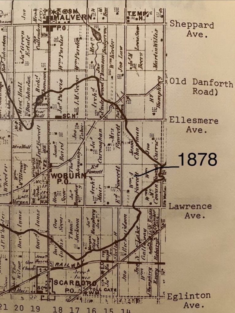
between 16/17 concession roads.
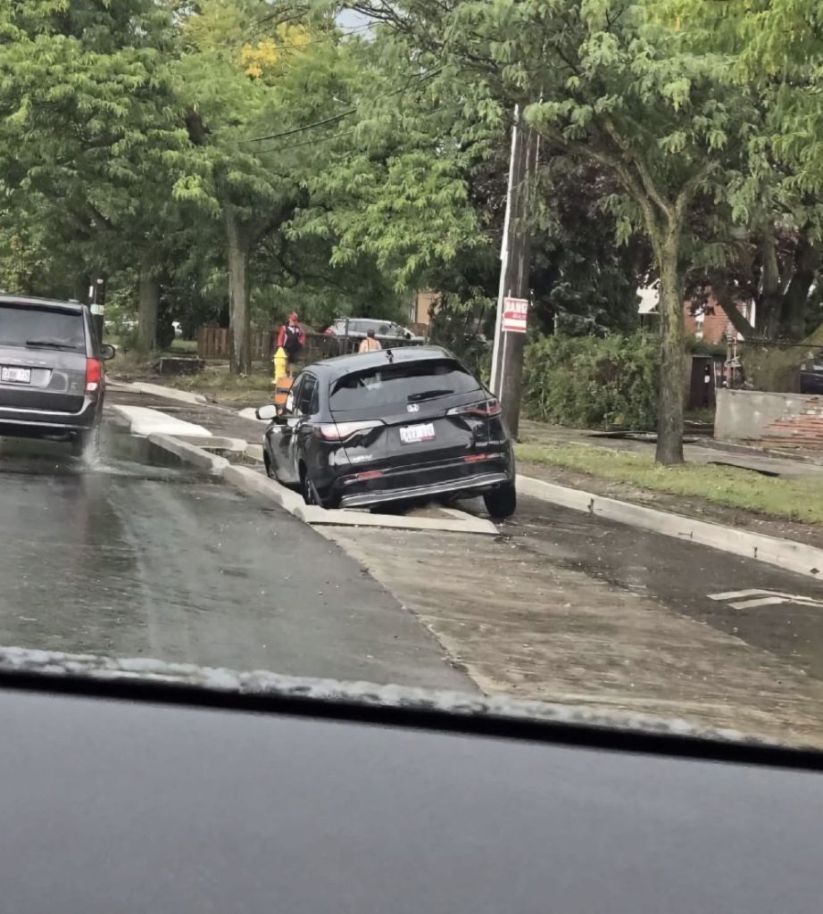
Club Rd.resulting from construction company not removing screenings covering storm drains, a
flooded road and the absence of signage/marking and an underwater lower curb of the raised
planter. The location of this is close to the north end of Golfdale Plaza (3750 Lawrence Ave.E.)
Photo shared by Michelle Vedder.
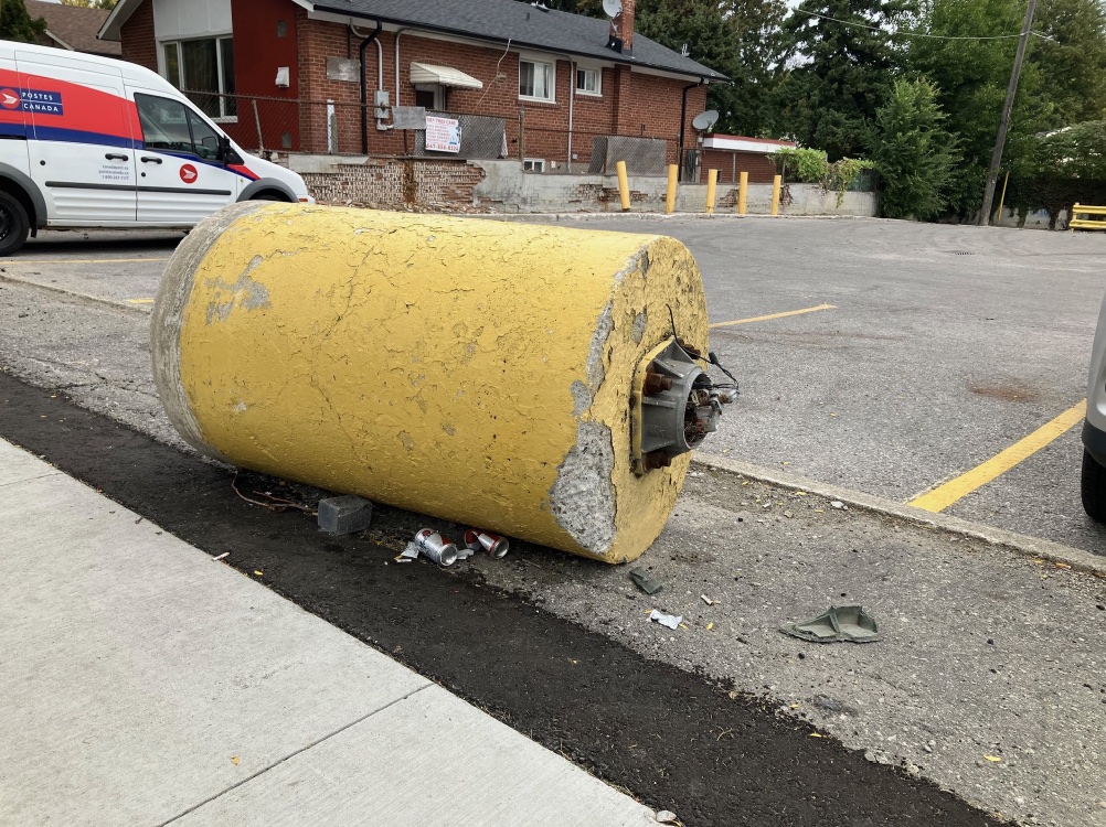
east (Plaza) or to the west (bike lane/ roadway)
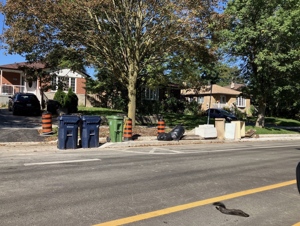
for motorists. As there is no enforcement for people putting out waste on the boulevard/ bike
lane area outside of when pick up of either recycle or garbage is collected, either category of
waste usually occupies the space for up to two weeks.
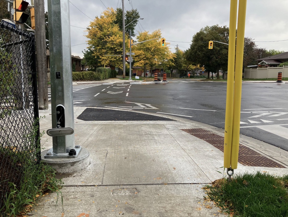
we see encroachment with the new wire fence on the left side immediately against the sidewalk.
Unlike the wider new sidewalk on Scarborough Golf Club Rd., Brimorton Drive has a narrower
width sidewalk that the company contracted by the city for snow removal does not effectively
plow without damaging property as a result of their machines being equipped with a larger
shovel. Here we also see a new light standard pole recently installed with the hydro pole
support wire to the right making the turning radius of the sidewalk even smaller and most likely
impossible to effectively machine clear the corner of snow, putting pedestrians at greater risk of
snow obstruction.
vantage point of the bike lane. Open drain with grate missing in area of bus stop (tripping
hazard).
Brimorton Drive. Construction debris with traffic cone.
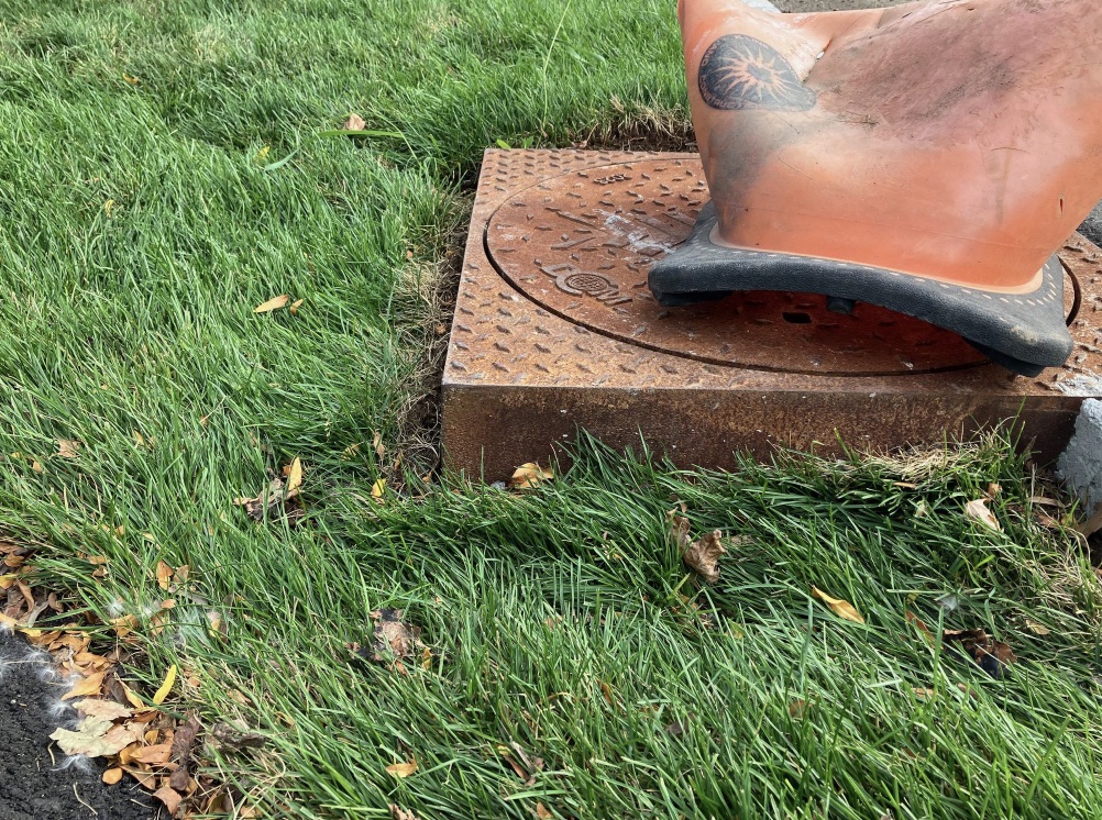
boulevard. noting the sharp corners (4) and its height there is a concern that as it is not level
with the terrestrial surface it would likely become a tripping risk for pedestrians.
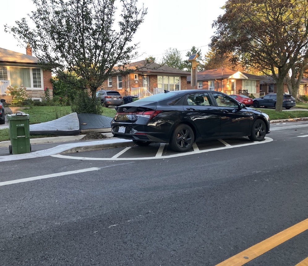
in a no parking designated turn radius area.The car parked here on the street produces a blind
spot for cars backing out of the adjacent driveway.
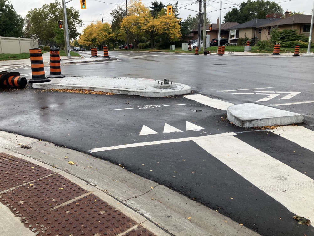
lane turn radius, the width of the entry from its approach, like much of the bike lane,
accommodates the width of an automobile.
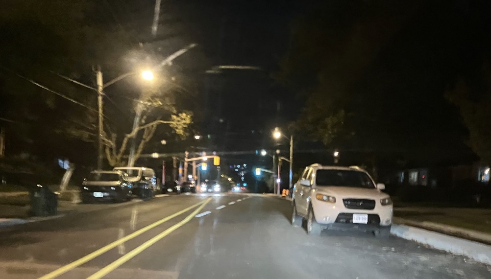
we see automobiles parked within the enclosed bike lane. Although the objective of the project
was to only allow street parking on the west side of Scarborough Golf Club and not on the east
side,in the absence of signage and other methods of notification to residents/visitors, this
renders the bike lanes unusable, forcing cyclists to use either the roadway or sidewalk thereby
placing not only the cyclists at risk but also the pedestrians and motorists.
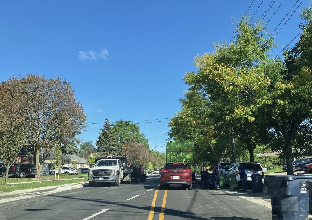
during waste pick up. A service vehicle is parked on the west side, on the east side a waste
service vehicle making stops along the road with traffic behind it, automobiles parked in the bike
lane, waste receptacle bins are placed close to the lane of traffic. In very windy weather waste
receptacle bins have a tendency to blow over and with the current reduced width of both lanes
of traffic it is therefore likely that if a bin were to blow over into a lane of traffic in peak traffic
times, this would create a road hazard.
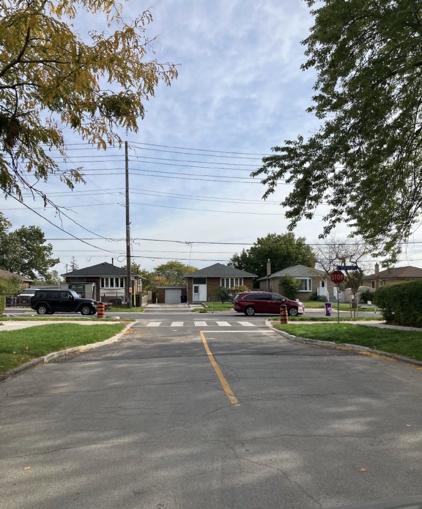
this picture, the original width of the road. Unlike Newark Rd. on the northeast end and Painted
Post Drive on the northwest sides of Scarborough Golf Club Rd.’s which both have only one half
of the road bottlenecked, Chandler Drive has both sides and is in close proximity to a school
where many of the children are dropped off and picked up by automobiles that park on this very
busy and now very dangerous side street. There currently are no signs on this street that
prohibit parking in close proximity to where the road intersects with Scarborough Golf Club Rd.
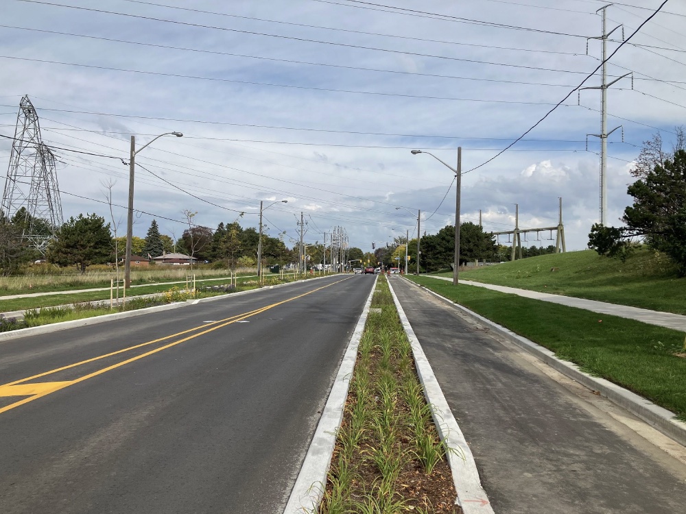
Ellesmere Rd. This photograph encapsulates a number of concerns related to driver safety, emergency
response time, snow removal services and orientation for drivers. From this visual of the road
we can see that with the reduced width of the lanes it would not be possible for drivers on either
side to pull over for an emergency vehicle or snow plow. The still to be enabled traffic light/
crossing for the Meadoway trail entrance south of the Ellesmere lights if both are not
coordinated effectively could potentially create a plug of traffic during peak times and reduce
response time for emergency vehicles with automobiles unable to pull over. Westbound and
northbound traffic at the Ellesmere intersection both occupy one lane. The east lane now
designated as a right turn lane only was commented by many on the walk as likely a difficult turn
for large trucks and emergency vehicles without entering the northbound/westbound lane to turn
around the enclosed bike lane radius sharing that corner.
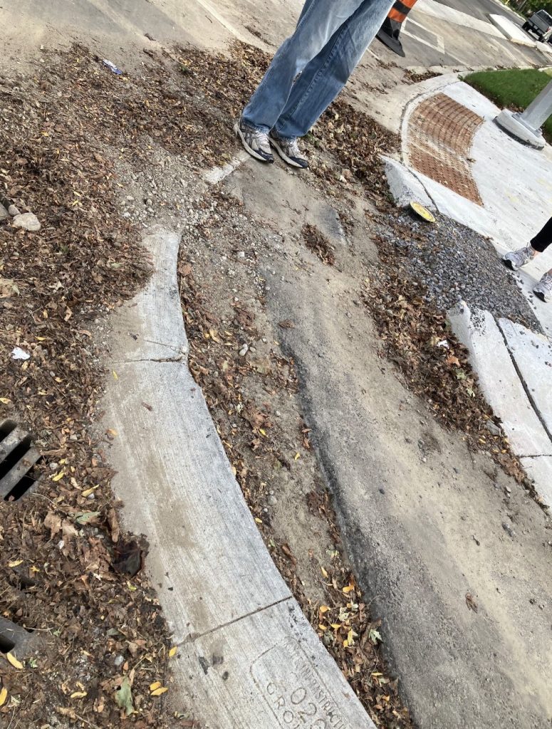
surface,(tripping hazard) spalling of concrete, unfinished post pour modification of concrete
curb, construction debris blocking storm drain.
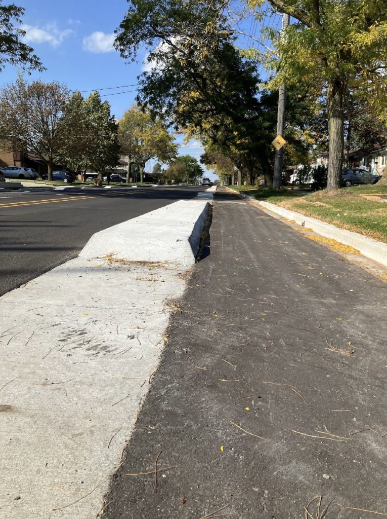
road looking north. In this photograph we see a platform curb on the outer side of the bike lane,
with ramp edges on both sides. There were a number of comments from participants of the walk
saying that children and some adults could likely use these types of curbs as ramps for
skateboard/bike stunts. Similar curbs like these in the south east side of the project area across
from the schools have barriers fastened onto the curb but a majority north of there do not. It was
a shared sentiment that these types of curbs, if they are to remain, should have some deterrent to discourage this type of activity so close to lanes of moving traffic.
Conclusion
In concluding this report it is my hope that this document might be considered useful in
addressing concerns and work towards agreeable solutions that work for most if not all people
who live along the road and/or travel it by foot, mobility device, bicycle or car on a regular basis.
This is by no means an exhaustive audit and there are likely other concerns and topics not
covered here. It is my hope that an opportunity is provided for a community meeting or survey
between residents and city staff that would allow individuals to also have their concerns
acknowledged and considered as transportation staff determines if and when a plan of action is possible.
Thank you,
Best regards,
Brian MacFarlane
President, Curran Hall Community Association
Scarborough, October 2026.